Cartogram
- Last Update
- 19 March 2013
- Regular License
- $15
- Extended License
- $75
- Sales
- 33
Showcase – LakeView Day Camp http://www.lakeviewdaycamp.com/facilities/
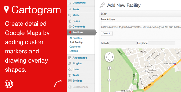
Demo can be accessed directly - http://demo.polevaultweb.com/cartogram/wp-admin/ This plugin allows you to create unlimited Google Maps that you can place in your posts, pages or theme template files using a shortcode. You can then customise a map by adding unlimited locations to the map.
Map Features
Complete control of the map position by using an address, adding a marker or entering a latitude and longitude manually. Zoom level Height and width (px or %) Map style (road, satellite, hybrid and terrain) Zoom and pan control styles and position Control of displaying the map type and street view controls. Control of the scrollwheel for mobile devices. Control of dragging of the map
Location Features
Set the name of a location and a description for the location. Enable an info window with the details if a marker is set, that appears when the marker is clicked. Add unlimited amount of overlay shapes to the map with a powerful administartion of the map using Google’S drawing controls. Shapes include rectangles, circles, polygons and markers. Control the colour, and opacity of a shape. Add a featured image which appears as a thumbnail in the info window. Enable a lightbox on the thumbnail to display the larger image. Add a gallery to the location that will appear in a lightbox when the thumbnail in the info window is clicked. Add a custom image and shadow to the marker(s). Control the anchor position of the custom marker image to the marker point. Ability to categorise the locations.
The plugin is extremely customisable with a number of filters to make it more specific to your site or your client’s site. You can customise the output of the locations list using the filters described below. Filters available
cartogram_menu_name – change the name of the menu in the main WordPress menu (default – Cartogram)
cartogram_single_name – change the name of the single item, eg. Add a new Facility (default – Location)
cartogram_plural_name – the plural version of the single_name, eg. View all Facilities (default – Locations)
cartogram_settings_capabilities – the capability level of a user allowed to see the Settings of the plugin (default – manage_options)
cartogram_thumbnail_size – the built in WordPress image size used for the lightbox images (default – thumbnail)
cartogram_lightbox_size – the built in WordPress image size used for the thumbnail in the info window (default – large)
cartogram_locations_wrapper_start – start of the wrapper for the whole locations list (default – )
cartogram_locations_category_title_start – when grouping by category the category name will be output after this filters. Another parameter of $custom_image will be available which is the last custom marker image of a location in the category. (default – <h4>)
cartogram_locations_category_title_end – when grouping by category the category name will be output before this filter. (default – ></h4>)
cartogram_locations_category_content_start – start of the content of a category group of locations. Helpful if you want to apply an accordian script to the list. (default – )
cartogram_locations_container_start – start of the list (default – <ul class="cartogram_locations">)
cartogram_locations_item_start – before an item. Another parameter of $custom_image will be available which is the custom marker image of the location (default – <li>)
cartogram_locations_item_end – end of an item (default – </li>)
cartogram_locations_container_end – end of the list (default – </ul>)
cartogram_locations_category_content_end – end of the content of a category group of locations. (default – )
cartogram_locations_wrapper_end – end of the wrapper for the whole locations list (default – )
cartogram_location_type – default for location type (default – options – , map, location)
cartogram_location_map – default for location map (default – 0)
cartogram_custom_marker – default for custom marker (default – off, options – on, off)
cartogram_custom_marker_image – default image for custom marker (default – )
cartogram_custom_marker_shadow – default image for custom marker shadow (default – )
cartogram_info_window_thumb – default for info window thumbnail (default – off, options – on, off)
cartogram_thumb_lightbox – default for thumbnail lightbox (default – off, options – on, off)
General Settings
Google Maps API key Custom CSS Automatic upgrades Full documentation
Changelog
= 1.0.4 =
Added – Option to re-center the map when info window is closed Fix – Map not showing in location admin Fix – Issues with circles Fix – Category listing when uncategorised there was no heading. Filter added for default category name – cartogram_no_category_name
= 1.0.3 =
Added – Default filters (see available filters above) Fix – Last location in category grouped list not in group Fix – Some images in gallery not appearing in lightbox
= 1.0.2 =
Fix – General bug fixes
= 1.0.1 =
Fix – Marker images not showing on first load Fix – No error when location list doesn’t link to location without a marker Added – Ability to turn off dragging on touch screen devices for a map
You may need to remove the frame if you click the Live Preview link.
